ExpertGPS
6.14
Size: 10.05 MB
Downloads: 22109
Platform: Windows (All Versions)

A GPS receiver is one of the most useful tools which you can take with you on a trip, but the device may not contain information about certain areas. Besides that, its small size and limited functions make it difficult to review a trip or plan a new one. If you have the possibility of connecting a GPS receiver to your computer, you can use ExpertGPS to exchange data in both directions. You can import your waypoints and tracklog and view them on aerial photos or topographic maps, plan a new route, with your own waypoints, and send it to the receiver and more.
ExpertGPS works on Windows XP, Vista and Windows 7. Downloading the setup file and installing its components will take about a minute and you can launch the software right away, without rebooting the computer or installing additional services.
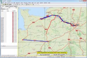
If you are familiar with Google Earth or other similar programs, you will notice that ExpertGPS has a familiar layout. The larger area of the interface consists of a map, on which you can zoom in and out with the mouse wheel and pan in any direction, by clicking and dragging. You can use different tools to place waypoints on the map, connect them, draw or trace routes and more. Once you draw a route, you may use different selection tools to modify it or highlight a certain portion of the route.
When you add a new waypoint on the map, the program will record its coordinates automatically. A new window will show up, on which you can type a label, a description or adjust the latitude and longitude, if you need to. It is also possible to specify the point's elevation, depth, proximity and temperature, in various measuring units. While configuring a way point, you may specify its type as well. The point can be anything, from a camp or fishing spot, to a dam or an airport. The point's icon will change automatically, depending on the selected type, but you can choose a different symbol if you want to.
The software allows you to transfer waypoints, routes, tracks and geocaches to and from a GPS receiver. You just need to click the appropriate option, on the program's toolbar, and select which items you want to send or receive. Alternatively, you may save and load GPS exchange files (.gpx). The best part is that you can load multiple GPX files, on separate layers, so you can see their data on the same map. Besides GPX files, the software supports Google Earth KML and KMZ files, Excel CSV files, SHP shape files and Autocad DXF. Furthermore, it allows you to convert to and from these formats, without too much effort.
Pros
You can transfer data between your computer and a GPS receiver. The software allows you to review your trips, plan new ones and much more. You may configure your own waypoints and associate them with a wide range of information.
Cons
You may need some time to study all the available functions. ExpertGPS gives you the possibility of creating and adjusting your own routes, however you want, regardless of what GPS receiver you are using.
ExpertGPS
6.14
Download
ExpertGPS Awards

ExpertGPS Editor’s Review Rating
ExpertGPS has been reviewed by Frederick Barton on 10 Dec 2012. Based on the user interface, features and complexity, Findmysoft has rated ExpertGPS 5 out of 5 stars, naming it Essential